Wave Wire Services
LOS ANGELES — The Metropolitan Transportation Authority is seeking public comments on the draft environmental impact report on a proposed eight-mile bike and walking path along the Los Angeles River between Elysian Valley and Maywood through downtown Los Angeles and Vernon.
Earlier this month, the transit agency released the draft report and began a 47-day public comment period that will end on Feb. 2. Los Angeles County residents and stakeholders are being asked to submit verbal and written comments about the project.
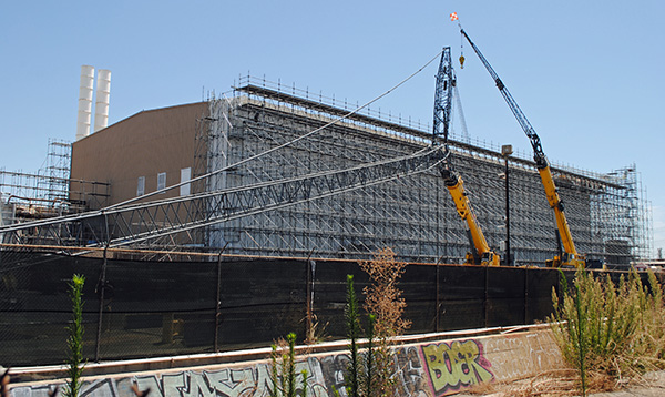
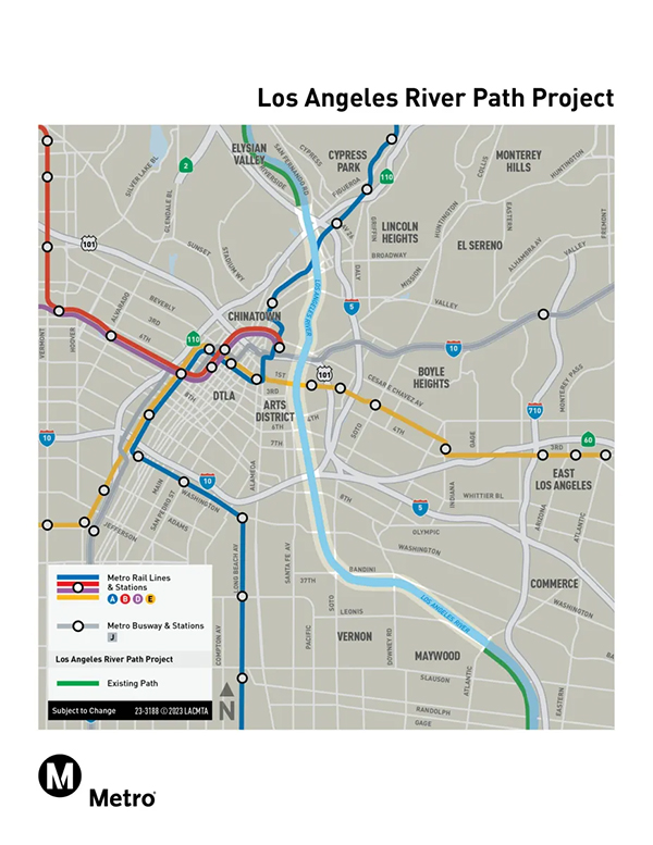
The eight-mile segment is expected to serve Elysian Valley, Cypress Park, Lincoln Heights, Chinatown, downtown LA, the Arts District, Boyle Heights, Vernon and Maywood. It’s part of the larger 32-mile Los Angeles River Path Project that aims to connect the San Fernando Valley with Long Beach.
“Projects like the LA River Path improve quality of life and provide mobility choices, foster connection and encourage more active lifestyles, all important goals as we look to build a transportation network worthy of a world-class city,” MTA Board Chair and Whittier City Councilman Fernando Dutra said in a statement.
Previously, the MTA anticipated completion of the eight-mile stretch in 2027, just in time for the 2028 Olympic and Paralympic Games, but officials pushed that timeline back a couple years as they finalize the environmental impact report.
Initially, the eight-mile river path was projected to cost $365 million, though now it’s likely to be more than $1 billion due to an increase in construction costs, among other issues.
Capital cost estimates for the project are around $595 million for a 3.2-mile northern segment, $688 million for a five-mile southern segment, and approximately $1 billion to $1.2 billion for the full eight-mile segment, depending on the alternative options selected by the MTA board.
The Los Angeles River Path Project is funded by Measure M, a 2016 voter-approved sales tax for transportation and infrastructure initiatives, as well as outside sources.
Alternative options for the project were informed by community and stakeholder input — with access as the top priority. While early feasibility studies placed the path entirely along the river’s west bank and mostly at the bottom of the channel, all current alternatives now include segments that are either cut along the channel embankment or on both the west and east banks that are linked by new bike and pedestrian-only bridges.
Most communities that stand to benefit from the project are located on the east bank and would not be adequately served by a west-bank-only alignment, officials said.
Additionally, residents helped with the selection of access points and key destinations. The eight-mile river path’s width was increased to 16-20 feet from what was originally a 12-foot path after community members raised concerns about not having enough space for cyclists and pedestrians.
With limited available right-of-way along the riverbank, all alternatives incorporate elevated, incised and top-of-bank segments along the highly constrained corridor.
A bottom-of-the-channel alternative was considered but not carried further because it failed to meet key goals for safety, access, sustainability and efficient mobility.
Other concerns the draft environmental impact report address include flood-related safety risks and closures, emergency access, length and grade of ramps and lighting and amenities.
Significant permitting and construction challenges also impacted design choices, as the path is expected to traverse private and public property.
During the environmental review process, the MTA is expected to identify an agency to construct, operate and maintain the river path before the project is approved and the design is advanced. The final environmental impact report is expected to be released later in 2026 or in 2027, according to the transit agency.
The MTA Board of Directors is expected give approval for the design and the outside agency that will manage the project before any construction can begin.
The MTA will conduct a series of public hearings on the project’s draft environmental impact report on the following days:
• Jan. 21, 6:30-7:30 p.m., Lincoln Heights Senior Center, 2323 Workman St.
• Jan. 27, 6-8 p.m., Maywood Center for Enriched Studies, 5800 King Ave.
• Jan. 29, 6-8 p.m., a virtual meeting via Zoom, which can be joined at https://bit.ly/larp_deir, and a dial-in option: 833 584 0276, using webinar ID: 833 2236 2142.
• And Jan. 31, 10 a.m.-noon, Felicitas and Gonzalo Mendez Senior High School, 1200 Plaza Del Sol E.
Live Spanish interpretation will be available at all public hearings.
Meetings also are accessible to individuals with disabilities. Other Americans with Disabilities Act accommodations and interpretation are available by calling 213-922-4710 at least 72 hours in advance.
Jose Herrera is a reporter for City News Service.